Invershin
| Invershin Gaelic: Inbhir Sin | |
| Sutherland | |
|---|---|
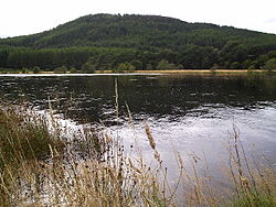
 The Kyle of Sutherland from Invershin | |
| Location | |
| Grid reference: | NH579952 |
| Location: | 57°55’27"N, 4°24’0"W |
| Data | |
| Post town: | Lairg |
| Postcode: | IV27 |
| Local Government | |
| Council: | Highland |
Invershin is a scattered village in southern Sutherland, six miles south of Lairg and four miles north of Bonar Bridge.
As its name suggests, Invershin is located near the point at which the River Shin has its confluence with another river, in this case the River Oykel. At this point river is tidal, and known as the Kyle of Sutherland as it opens out towards the Dornoch Firth.
The river here forms the county border with Ross-shire, and on the opposite bank lies the village of Culrain. The two are joined by the Shin Viaduct, a railway bridge on the Far North line between Inverness and Wick. Road traffic wishing to cross requires a nine-mile detour via Bonar Bridge, but as each village has a station, a traveller can make the journey by train in under a minute. There is also an adjacent footbridge to Culrain, opened in May 2000, largely for visitors to Carbisdale Castle Youth Hostel, who used to walk illegally over the railway bridge to get to Invershin.
This Sutherland article is a stub: help to improve Wikishire by building it up.