Carnyorth
From Wikishire
Revision as of 17:20, 20 July 2016 by RB (Talk | contribs) (Created page with "{{Infobox town |name=Carnyorth |cornish=Karnyorgh |county=Cornwall |picture=Engine House at Botallack - geograph.org.uk - 712255.jpg |picture caption=Engine House at Botallack...")
| Carnyorth Cornish: Karnyorgh | |
| Cornwall | |
|---|---|
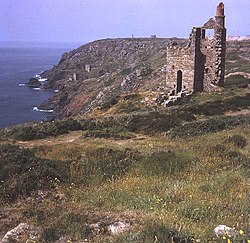
 Engine House at Botallack | |
| Location | |
| Location: | 50°8’17"N, 5°40’34"W |
| Data | |
| Local Government | |
| Council: | Cornwall |
Carnyorth is a hamlet in western Cornwall, about a mile south of Pendeen and six miles northwest of Penzance. It sits alongside the B3306 road which connects St Ives to the A30 London-Penzance trunk road.
Carnyorth lies within the Cornwall Area of Outstanding Natural Beauty, as does almost a third of the county.
Outside links
| ("Wikimedia Commons" has material about Carnyorth) |