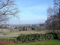
Bodelwyddan
From Wikishire
Revision as of 23:28, 18 August 2012 by RB (Talk | contribs) (Created page with '{{Infobox town |name=Bodelwyddan |county=Flintshire |picture=The Marble Church from Bodelwyddan Park - geograph.org.uk - 124539.jpg |picture caption=Bodelwyddan |os grid ref=SJ0…')
| Bodelwyddan | |
| Flintshire | |
|---|---|
 Bodelwyddan | |
| Location | |
| Grid reference: | SJ0075 |
| Location: | 53°16’5"N, 3°29’56"W |
| Data | |
| Population: | 2,106 (2001) |
| Post town: | Rhyl |
| Postcode: | LL18 |
| Dialling code: | 01745 |
| Local Government | |
| Council: | Denbighshire |
| Parliamentary constituency: |
Vale of Clwyd |
Bodelwyddan is a village in Flintshire, a place of only 2,106 souls in 2001. The village lies 3½ miles east of Abergele, 5 miles south of Rhyl, and 15½ miles northwest of Ruthin.
Notable buildings include the Marble Church, built by John Gibson in the 1850s; Bodelwyddan Castle, now used as a branch of the National Portrait Gallery; and Ysbyty Glan Clwyd, the major hospital for central North Wales.
The hamlet of Pengwern lies to its north and east at SJ016764.
Outside links
- The Marble Church Website
- A Vision of Britain Through Time
- British Listed Buildings
- Information on Bodelwyddan from GENUKI
- Pictures on Geograph.co.uk
- National Portrait Gallery