Dudswell
| Dudswell | |
| Hertfordshire | |
|---|---|
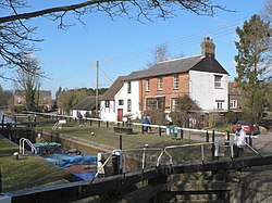
 Lock on the canal at Dudswell | |
| Location | |
| Grid reference: | SP965095 |
| Location: | 51°46’33"N, -0°36’10"W |
| Data | |
| Postcode: | HP4 |
| Local Government | |
Dudswell is a hamlet in Hertfordshire, 2 miles north-west of Berkhamsted just off the A4251. The closest town is Northchurch, which is contiguous with Berkhamsted along the Bulbourne valley.
Dudswell sits beside the River Bulbourne and the Grand Union Canal.

This Hertfordshire article is a stub: help to improve Wikishire by building it up.