Rotherfield Greys
| Rotherfield Greys | |
| Oxfordshire | |
|---|---|
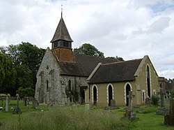
 St Nicholas' parish church | |
| Location | |
| Grid reference: | SU725825 |
| Location: | 51°32’13"N, -0°57’14"W |
| Data | |
| Population: | 350 (2011) |
| Post town: | Henley-on-Thames |
| Postcode: | RG9 |
| Dialling code: | 01491 |
| Local Government | |
| Council: | South Oxfordshire |
| Parliamentary constituency: |
Henley |
Rotherfield Greys is a village in the Chiltern Hills in the south-east of Oxfordshire, two miles west of Henley-on-Thames and just over a mile east of Rotherfield Peppard. It is linked by a near-straight minor road to Henley.
History
The Domesday Book of 1086 mentions Rotherfield Greys under the ownership of the Norman knight Anchetil de Greye.[1] Rotherfield derives from the Old English hreðerfeld meaning "cattle field". Around 1347, Rotherfield Greys Castle was built at here; it is now in ruins.
The parish church includes the 16th-century Knollys Chapel, which houses an ornate tomb of the Knollys family. This includes effigies of Sir Francis Knollys and his wife, who was lady-in-waiting to Queen Elizabeth I.
About the village
The Church of England parish church, St Nicholas[2] is Norman and was restored in 1865.[3] The village has a public house, The Maltsters Arms.
In the parish is Greys Court, owned and maintained by the National Trust. whose predecessor was the manor house of the Grey family. It and its Dower House arw Grade I listed buildings.[4]
Gallery
| ("Wikimedia Commons" has material about Rotherfield Greys) |
-
The Maltsters Arms
-
Ruins of Rotherfield Greys Castle
Outside links
- A birds-eye view of Greys Court Rotherfield Greys in the 17th or 18th century from SCRAN
- Greys Court at Rotherfield
- Roll of Honour
- Rotherfield Greys Parish
References
- ↑ Greys Rotherfield Greys in the Domesday Book
- ↑ St. Nicholas' Church, Rotherfield Greys
- ↑ Sherwood & Pevsner 1974, p. 734.
- ↑ National Heritage List 1181202: Greys Court (Grade I listing)
- Nikolaus Pevsner: The Buildings of England: Oxfordshire, 1974 Penguin Books ISBN 978-0-300-09639-2
- A History of the County of Oxford - Volume 16 pp 266-302: Rural Parishes: Rotherfield Greys (Victoria County History)


