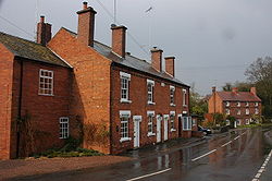
Drayton, Worcestershire
| Drayton | |
| Worcestershire | |
|---|---|

| |
| Location | |
| Grid reference: | SO906760 |
| Location: | 52°22’57"N, 2°8’20"W |
| Data | |
| Post town: | Stourbridge |
| Postcode: | DY9 |
| Local Government | |
| Council: | Wyre Forest |
Drayton is a hamlet in Worcestershire. Running through the village is the Belne Brook, which originates in the Clent Hills and flows down through Belbroughton and to Drayton. It is a tributary of the River Stour.
History
Charcoal and water-powered forges were a major feature in the area, the water used to turn sharpening wheels for scythe-making.[1] There was once a water-mill here: there is still a mill-pond,[1] a mill building (which now houses local businesses) and 19th century terraced housing, all of which is evidence of the former industry.
| ("Wikimedia Commons" has material about Drayton, Worcestershire) |
References
- ↑ 1.0 1.1 Local Walks: Chaddesley Corbett, Worcester News, http://www.worcesternews.co.uk/features/countrynews/localwalks/4078156.Chaddesley_Corbett/, retrieved August 6, 2013
