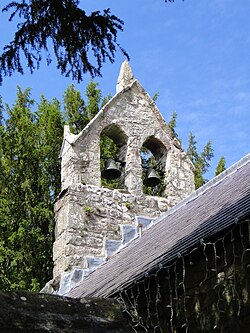
Llanidan
| Llanidan | |
| Anglesey | |
|---|---|

| |
| Location | |
| Location: | 53°10’44"N, 4°16’23"W |
| Data | |
| Local Government | |
| Council: | Anglesey |
| Parliamentary constituency: |
Ynys Môn |
Llanidan is a parish in south-west Anglesey which includes the village of Brynsiencyn. The parish is located along the Menai Strait, approximately 4 miles north-east of Caernarfon (across the strait). The parish church of St Nidans is located near the A4080 highway, a little to the east of Brynsiencyn. The ruins of an earlier parish church survive.
History
It has been suggested that it was here that the Roman general Suetonius landed in 60 AD, and then again in 78 AD by Agricola, in their efforts to pacify the Ordovices of these regions and Anglesey, at a spot known as Bryn Beddau, ("Hill of Graves").[1]
In the Middle Ages the parish was part of the commote of Menai, in cantref Rhosyr.
Notable inhabitants
Amongst the notable people associated with the parish are Henry Rowlands, who was the rector of Llanidan when he published Mona Antiqua Restaurata in 1723, and the industrialist Thomas Williams of Llanidan, who lived in Plas Llanidan.
Stud
There is a horse stud located there; Llanidan Stud breeds Welsh ponies of Cob type (section C) and Welsh Cobs (section D) and is owned by E.W Jones.