Sleightholme
| Sleightholme | |
| Yorkshire North Riding | |
|---|---|
 Sleightholme Moor Road | |
| Location | |
| Grid reference: | NY955102 |
| Location: | 54°29’14"N, 2°4’13"W |
| Data | |
| Local Government | |
| Council: | County Durham |
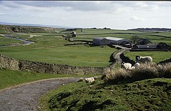
Sleightholme is a secluded hamlet on a dead-end road in the North Riding of Yorkshire. It stands in Sleightholme Dale, beside Sleightholme Beck, a tributary of the River Greta. The nearest town is Bowes, four miles away.
The name, first recorded in 1254, is believed to come from the Old Norse sletta holmr, meaning "flat ground near water".
The Pennine Way passes through Sleightholme. Below the hamlet Sleightholme Beck passes through a narrow valley, known as The Troughs, which is a Site of Special Scientific Interest.
The Pennine Way and A Pennine Journey, following the same footpaths, run down the Frumming Beck and the Sleightholme Beck through Sleightholme.
Outside links
| ("Wikimedia Commons" has material about Sleightholme) |
