Wansford, Yorkshire
| Wansford | |
| Yorkshire East Riding | |
|---|---|
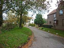
 Chapel Lane, Wansford | |
| Location | |
| Grid reference: | TA062564 |
| Location: | 53°59’35"N, 0°22’53"W |
| Data | |
| Post town: | Driffield |
| Postcode: | YO25 |
| Dialling code: | 01377 |
| Local Government | |
| Council: | East Riding of Yorkshire |
| Parliamentary constituency: |
East Yorkshire |
Wansford is a village in the East Riding of Yorkshire, sitting beside the B1249 road and just to the north of the River Hull and the Driffield Canal. It is two and a half miles south-east of Driffield and three miles north-west of North Frodingham.

The church of St Mary the Virgin, Wansford was built in 1866–68 to designs by G.E. Street. It is on the Sykes Churches Trail devised by the East Yorkshire Churches Group.[1] The church is a Grade II* listed building.[2]
| ("Wikimedia Commons" has material about Wansford, Yorkshire) |
References
- ↑ "Sykes Churches Trail Southern Route". East Yorkshire Historic Churches Group.
- ↑ National Heritage List 1162211: Church of St Mary the Virgin (Grade II* listing)
- Gazetteer — A–Z of Towns Villages and Hamlets. East Riding of Yorkshire Council. 2006. p. 11.
