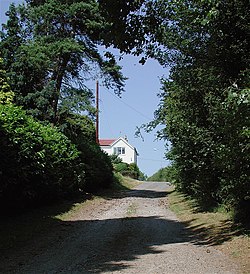
Ryehill, Yorkshire
| Ryehill | |
| Yorkshire East Riding | |
|---|---|
 Marsh Lane, Ryehill | |
| Location | |
| Grid reference: | TA222257 |
| Location: | 53°42’51"N, 0°8’55"W |
| Data | |
| Post town: | Hull |
| Postcode: | HU12 |
| Dialling code: | 01964 |
| Local Government | |
| Council: | East Riding of Yorkshire |
| Parliamentary constituency: |
Beverley and Holderness |
Ryehill is a hamlet in the East Riding of Yorkshire, on Holderness. It is about seven miles east of Kingston upon Hull city centre and lies just south of the A1033 road; the main road from Hull to Withernsea.
Ryhill was served from 1854 to 1964 by Burstwick railway station on the Hull and Holderness Railway.[1]
The hamlet itself consists of 15 or so houses, and two main lanes that run through the hamlet are Marsh and Pitt Lanes (both of these are 30 mph). Ryehill is mainly known for its pub, The Crooked Billet. Ryehill is surrounded by fields and grazing land, but is within walking distance of the villages of Thorngumbald and Keyingham, both of which offer all the local amenities.
| ("Wikimedia Commons" has material about Ryehill) |
References
- ↑ Butt, R. V. J. (1995). The Directory of Railway Stations: details every public and private passenger station, halt, platform and stopping place, past and present (1st ed.). Sparkford: Patrick Stephens Ltd. ISBN 978-1-85260-508-7. OCLC 60251199.
- Gazetteer — A–Z of Towns Villages and Hamlets. East Riding of Yorkshire Council. 2006. p. 10.
