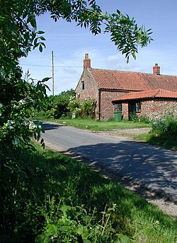
Owstwick
| Owstwick | |
| Yorkshire East Riding | |
|---|---|
 Quaker Road, Owstwick | |
| Location | |
| Grid reference: | TA272327 |
| Location: | 53°46’31"N, 0°4’15"W |
| Data | |
| Post town: | Hull |
| Postcode: | HU12 |
| Dialling code: | 01964 |
| Local Government | |
| Council: | East Riding of Yorkshire |
| Parliamentary constituency: |
Beverley and Holderness |
Owstwick is a hamlet in the East Riding of Yorkshire, on Holderness in the east of the East Riding. It is approximately eleven miles east of Kingston upon Hull city centre and five miles north-west of Withernsea.
History
The Domesday Book lists the settlement name as "Hostewic" and "Ostewic", under the manors and lords of Kilnsea and Hilston, and in the Wapentake of Holderness. At the Norman Conquest the lords of Holderness, and therefore Owstwick, were Earl Morcar and Murdoch of Hilston. Owstwick was a small settlement of about 5 households, with 45 villeins, 6 freemen, one priest and a church. There were 44 ploughlands]] and a meadow of 12 acres. In 1086 lordship was transferred to Drogo of la Beuvriëre, who also became Tenant-in-chief to the King. Domesday records that in Edward the Confessor's time the combined manor of Hilston with parts of Owstwick was valued at fifty-five shillings.[1]
The Dictionary of British Place Names gives the derivation of Owstwick as "eastern outlying farm" from the Old Scandinavian 'austr' and the Old English 'wic'.[2]
Owstwick in 1812 had a population of 106. There were 18 families in 18 houses, with 17 farmers and one trader.[3] By 1823 population had increased to 139, including four farmers and a Tuesday carrier to Hull; occupation numbers had not changed by 1851, although population had dropped to 103.[4][5][6]
In 1818, in the part of Owstwick that was in Roos, inhabitants numbered 59. A parliamentary report of the following year stated that in the parish there were three schools, in each of which 30 children were taught, about two thirds of whom belonged to the parish. There was a Sunday School where 30 boys and 25 girls were taught. The report stated that: "the greater part of the poorer classes are without the means of education, and very desirous of possessing them."[7]
A Tithe Commission under the 1836 Tithe Commutation Act recorded Owstwick township as consisting of 1,330 acres, largely within the parish of Roos, with 452 acres in the parish of Garton. By 1841, although Owstwick was called a 'manor', no manorial rights then existed. In 1780 principal parish landowners had been Sir Christopher Sykes and Admiral Storr; by 1841 they were Sir Tatton Sykes, Admiral Mitford, and Joseph Storr.[6]
In 1882 the number of inhabitants had dropped to 80, of whom six were farmers. A Society of Friends']] burial ground still existed, although their meeting house had been converted to a cottage.[6][8] In 1913 Sir Tatton Sykes of Sledmere House was lord of the manor and principal landowner. Inhabitants in 1911 numbered 114, with four farmers, and children attending school at Garton.[9]
Outside links
| ("Wikimedia Commons" has material about Owstwick) |
- Owstwick in the Domesday Book
References
- ↑ Owstwick in the Domesday Book
- ↑ Mills, Anthony David: 'A Dictionary of British Place-Names' (Oxford University Press, 2003) ISBN 978-0-19-852758-9
- ↑ Strickland, Henry, Eustasius; A General View of the Agriculture of the East-Riding of Yorkshire, (1812), p.310. Reprint Nabu Press (2010). ISBN 1142231747
- ↑ Baines, Edward; History, Directory & Gazetteer of the County of York (1823), p.375. ISBN 1230139141
- ↑ General Directory of Kingston-upon-Hull, and York (1851), Francis White & Co., p.550
- ↑ 6.0 6.1 6.2 Sheahan, J. J.; Whelan, T.; (1857), History and topography of the City of York, the East Riding of Yorkshire, and a portion of the West Riding Volume 2, pp.360, 373, 376 ISBN 1150446110.
- ↑ "Roos" in A Digest of Parochial Returns Made to The Select Committee appointed to inquire into The Education of the Poor, House of Commons (1818), p.1089
- ↑ White, William, White's General and Commercial Directory of Hull (1882), p.338
- ↑ Kelly's Directory of the North and East Ridings of Yorkshire (with the cities of York and Hull) (1913), p.600
- Gazetteer — A–Z of Towns Villages and Hamlets. East Riding of Yorkshire Council. 2006. p. 9.
