North Duffield
| North Duffield | |
| Yorkshire East Riding | |
|---|---|
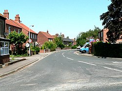
 Main Street, North Duffield | |
| Location | |
| Grid reference: | SE684369 |
| Location: | 53°49’26"N, -0°57’45"W |
| Data | |
| Population: | 1,317 (2011) |
| Post town: | Selby |
| Postcode: | YO8 |
| Local Government | |
| Council: | North Yorkshire |
| Parliamentary constituency: |
Selby |
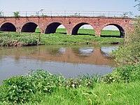
North Duffield is a village in the East Riding of Yorkshire, about four and a half miles north-east of Selby (across the river in the West Riding) and eleven miles south-east of York, on the A163 road from Selby to Market Weighton. The River Derwent forms the eastern boundary of the parish, and mars the oundary of the East Riding with the West Riding.
The parih population at the 2011 Census was 1,317.
This is a petty village, with a village green with duck pond, a village hall, a Methodist church, a primary school and a range of local shops.
Menthorpe Gate railway station on the Selby to Driffield Line served the village from 1853 to 1953.[1]

Sport and leisure
Football: North Duffield Dragons, for children aged between 3 and 16
There is an active North Duffield Conservation and local History Society.[2]
Outside links
| ("Wikimedia Commons" has material about North Duffield) |
References
- ↑ Butt, R. V. J. (1995). The Directory of Railway Stations: details every public and private passenger station, halt, platform and stopping place, past and present (1st ed.). Sparkford: Patrick Stephens Ltd. ISBN 978-1-85260-508-7. OCLC 60251199.
- ↑ "North Duffield Conservation & Local History Society". http://www.ndchs.org.uk. Retrieved 28 July 2011.
