Egton
| Egton | |
| Yorkshire North Riding | |
|---|---|
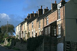
 The High Street, Egton | |
| Location | |
| Grid reference: | NZ808063 |
| Location: | 54°26’46"N, -0°45’18"W |
| Data | |
| Population: | 448 (2011) |
| Post town: | Whitby |
| Postcode: | YO21 |
| Local Government | |
| Council: | North Yorkshire |
| Parliamentary constituency: |
Scarborough and Whitby |
Egton is a village in the North Riding of Yorkshire, about five miles west of Whitby, within the North York Moors National Park. There is a nearby village called Egton Bridge, where Egton railway station is found.
The village was included in the Survey of English Dialects, published in various forms between 1962 and 1996. Unlike the other sites, a full book was written on the local dialect by Hans Tidholm.[1]
According to the 2011 census, Egton parish had a population of 448.
History

Egton is an important local centre for family history. Prior to 1880, many important birth, marriage and death records were administered from Egton parish. The church in Egton holds detailed transcriptions of parish records. The cemetery is half a mile west, at the old church site. After 1870 many parishioners were buried at nearby Aislaby.

Events
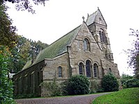
The Egton Road Race or Gooseberry Run is an annual charity race around the village, which was first held in 2001 to raise funds to save St Hilda's Chapel from demolition.[2]
Sport
- Cricket: Egton Cricket Club
Outside links
| ("Wikimedia Commons" has material about Egton) |
References
- ↑ Tidholm, Hans. The Dialect of Egton in North Yorkshire.
- ↑ "The Egton road race and fun run – also known as the Gooseberry Run after the famous Gooseberry Show.". Gazette Live. 7 June 2007. https://www.gazettelive.co.uk/news/local-news/egton-road-race-fun-run-3743821. Retrieved 17 October 2021.
