Drub
| Drub | |
| Yorkshire West Riding | |
|---|---|
 Drub Lane | |
| Location | |
| Grid reference: | SE197269 |
| Location: | 53°44’19"N, 1°42’9"W |
| Data | |
| Postcode: | BD19 |
| Local Government | |
| Council: | Kirklees |
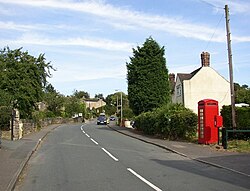
Drub is a hamlet in the West Riding of Yorkshire, standing between Cleckheaton, Birkenshaw, and Gomersal: it is considered part of the latter.[1]
References
- ↑ "Gomersal West Riding". A vision of Britain through time. GB Historical GIS / University of Portsmouth. http://www.visionofbritain.org.uk/place/place_page.jsp?p_id=190. Retrieved 15 March 2018.