Upton, Huntingdonshire
| Upton | |
| Huntingdonshire | |
|---|---|
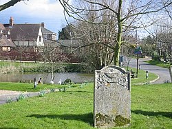
 Upton from the churchyard | |
| Location | |
| Grid reference: | TL175785 |
| Location: | 52°23’31"N, 0°16’29"W |
| Data | |
| Postcode: | PE26 |
| Local Government | |
| Council: | Huntingdonshire |
Upton is a small, picturesque village in Huntingdonshire, its houses and cottages grouped around the parish church, and all but the little village green and pond.
Upton stands at the edge of the fen, just to the west of the A1(M). From here the lanes lead off to nowhere directly, but the hamlet of Coppingford (which shares a parish council with Upton) is to the north and Alconbury Weston is to the south. Hamerton with its zoo lies off further west up the Alconbury Brook, and besides these there is nothing to be seen around but farms and their cottages, and the roaring of the motorway half a mile to the east.
The parish church, St Margaret, stands at the heart of the village. Of Early English pattern, it topped with a short but pleasing broach spire. There has been a church in Upton since before the Domesday Survey of 1086. No part of that structure now remains though, with the earliest parts of the present church being the south porch, and the font, both of which date from the 12th century. The chancel, the nave arcades and the south aisle all date from the early 13th century. The tower is 15th century, and replaced a bellcote which stood there previously.[1]