Balls Cross
| Balls Cross | |
| Sussex | |
|---|---|
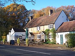
 The Stag, Balls Cross | |
| Location | |
| Grid reference: | SU987263 |
| Location: | 51°1’40"N, -0°35’36"W |
| Data | |
| Post town: | Petworth |
| Postcode: | GU28 |
| Local Government | |
| Council: | Chichester |
| Parliamentary constituency: |
Arundel and South Downs |
Balls Cross is a hamlet in Sussex, a mile south of Ebernoe (a village barely bigger and to whose civil parish it is allocated) and a mile and a half west of Kirdford. It is in the north-east of the county, in the lowland between the Weald to the north-east and the South Downs to the south.
The hamlet comprises a few houses together with a small garage and a pub, The Stag Inn at the junction of the road to Northchapel with the road from Petworth to Kirdford. Not far to the north, fields at Butcherlands Farm have been purchased by the Sussex Wildlife Trust which will be allowed to revert to pasture woodland over many years to double the size of the nationally important Ebernoe Common nature reserve.[1]
Outside links
| ("Wikimedia Commons" has material about Balls Cross) |
