Clanfield, Hampshire
| Clanfield | |
| Hampshire | |
|---|---|
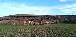 Clanfield, from the hill | |
| Location | |
| Grid reference: | SU697168 |
| Location: | 50°56’49"N, 1°0’29"W |
| Data | |
| Population: | 4,637 (2011) |
| Post town: | Waterlooville |
| Postcode: | PO8 |
| Dialling code: | 023 |
| Local Government | |
| Council: | East Hampshire |
| Parliamentary constituency: |
Meon Valley |
Clanfield is a village in the south-east of Hampshire, found two and a half miles north of Horndean, twelve miles north of Portsmouth and six miles south of Petersfield.[1] It sits to the west of the main A3 road, just north of where the A3(M) motorway section ends.[1]
The surrounding villages are Horndean, Catherington, Hinton Daubney, Chalton, East Meon, and Hambledon It has a semi-rural character with three sides of the village being adjoined by fields including Queen Elizabeth Country Park. Clanfield is overlooked from the other side of the A3 road by Windmill Hill and the Chalton Windmill which stands at 633 feet above sea level.
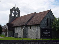
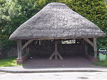
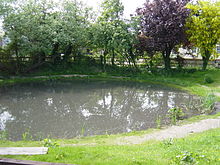
The population of Clanfield was measured as 4,854 in 2011: since the 2011 census means that this is expected to have increased and was estimated to be over 6,000 by 2017[1] Clanfield is a popular area for walkers, with Queen Elizabeth Country Park being next to the village. The old village also has a restored pond, a thatched village well, the Clanfield memorial hall, and the church of St. James.
Clanfield consists of two parts, "Old" Clanfield and "New" Clanfield. Old Clanfield has been around for roughly 250 years and New Clanfield about 60 years.
History
The name Clanfield is derived from the Old English and means "cleared field".[2] Clanfield was historically a small farming community centred about the church of St James, that dates from 1305 and was rebuilt in 1875 and contains two ancient mediæval bells. The community in 1929 recorded the population as 129, by the late 1940s almost 500, and in 1998 over 4500, with almost 1700 households.
The South Downs National Park borders Clanfield on three sides (east, north and west) and includes a large part of the undeveloped part of the village to the north (the former Area of Outstanding Natural Beauty).
Community and sport
There are three parks in Clanfield. All have swings and other child play items and Peel Park has a skateboard park. There is a park near the Sports centre in the new housing estate.
South Lane Meadow has a cricket ground, and Peel Park has football pitches. Peel park has a building with changing rooms in.
- Football: Clanfield F.C.
Clanfield Observatory is run by the Hampshire Astronomical Group,[3] who have open days.
Pictures
| ("Wikimedia Commons" has material about Clanfield, Hampshire) |
 |
 |
 |
 |
Outside links
- A History of the County of Hampshire - Volume 3 pp 110-111: Parishes: Clanfield (Victoria County History)
References
- ↑ 1.0 1.1 1.2 Clanfield Village
- ↑ Tim Lambert (14 March 2021). "A History of Clanfield". http://www.localhistories.org/clanfield.html.
- ↑ Hampshire Astronomical Group - Clanfield Observatory
