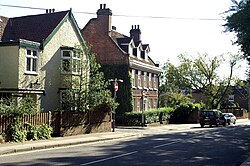
Forty Hill
| Forty Hill | |
| Middlesex | |
|---|---|
 Forty Hill | |
| Location | |
| Grid reference: | TQ336981 |
| Location: | 51°39’57"N, 0°4’2"W |
| Data | |
| Post town: | Enfield |
| Postcode: | EN1, EN2 |
| Dialling code: | 020 |
| Local Government | |
| Council: | Enfield |
| Parliamentary constituency: |
Enfield North |
Forty Hill is a largely residential suburb in the north of Middlesex. To the north of Forty Hill is Bulls Cross, and to the south Enfield. To the west is Clay Hill, and to the east Enfield Highway.
This place was recorded as Fortyehill 1610, Fortie hill 1619, Fortee hill 1686, named from Fortey c.1350, that is ' the island (of higher ground) in marsh ', from Old English forþ eg with reference to the slightly rising ground above the River Lea marshes.[1]
History
There have been houses in the road now known as Forty Hill since at least 1572.[2] The area includes the historic Forty Hall, built in the 17th century in the grounds of the former Tudor palace of Elsyng. In its grounds is the older (16th or early 17th-century) Dower House. Other older buildings nearby include the early 18th century Worcester Lodge and later 18th century Elsynge House and Sparrow Hall, and the 19th century Elms and Clock House. George Birkbeck (founder of what is now Birkbeck, University of London) lived at Forty Hill in the 1820s.[2] Jesus Church, near Maiden's Bridge, was built in 1835 and the nearby school in 1851. Goat Lane is named after a pub established before 1794[3] which was replaced by a large building in mock-Elizabethan style in the 1930s; this has since been converted to flats. Some housing was built during Victorian times but most of the area consists of terraced houses and maisonettes built in the 1930s.
Places of interest
Forty Hall Manor and Country Park is a manor with gardens, both of which can be explored. It is open all year round. Many events and exhibitions are held here. The London Loop long-distance footpath follows the Turkey Brook to the north of Forty Hall. Nearby to the north in Bulls Cross are Myddelton House Gardens (former home of botanist E. A. Bowles, open at certain times during the year) and Capel Manor horticultural college with 74 acres of grounds open to the public, including a maze and themed gardens. Special events take place here throughout the year. Also nearby are Whitewebbs Park and Clay Hill House.
Geology

The hill which gives its name to the district lies to the north of the built-up area and is mainly occupied by Forty Hall and its grounds. It rises to a plateau around 165 feet above sea level composed of the Boyn Hill Gravel, a deposit laid down by the River Lea approximately 400,000 years ago, when that river lay further to the west, and at a higher altitude than it does today. To the west and north is the valley of the Turkey Brook, which meets the Cuffley Brook here before flowing east to the Lea; the valley has cut through the gravels to the underlying London clay. To the south and east are the lower and later gravels and 'brickearths' of the Lea Valley. The former course of the New River runs up the north side of the Turkey Brook valley north and west of the hill, before crossing the valley to run south-east between Forty Hill and Clay Hill, the limit of the higher glacial hills to the west.[4] The New River has since been straightened to flow southwards to the east of Forty Hill, using an aqueduct to cross Turkey Brook near Maidens Bridge.
Outside links
- Jesus Church: Church of England
- The school linked with Jesus church
References
- ↑ Mills, Anthony David Dictionary of London Place Names. Oxford University Press, 2001. ISBN 0-19-280106-6.
- ↑ 2.0 2.1 A History of the County of Middlesex - Volume 5 pp 212-218: Enfield: Growth before 1850 (Victoria County History)
- ↑ A History of the County of Middlesex - Volume 5 pp 239-241: Hendon, Kingsbury, Great Stanmore, Little Stanmore, Edmonton Enfield, Monken Hadley, South Mimms, Tottenham (Victoria County History)
- ↑ BGS 2006, England and Wales Sheet 256 North London, 1:50,000 Geology Series, British Geological Survey, Keyworth, ISBN 0-7518-3427-0