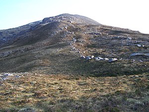
Ben Hee
| Ben Hee | |
| Sutherland | |
|---|---|
 Ben Hee | |
| Summit: | 2,840 feet NC426339 58°15’57"N, 4°41’2"W |
Ben Hee is a mountain that rises to the height of 2,840 feet in the midst of Sutherland.
Below the forbidding crags of its eastern edge lies a loch, Loch a' Ghorm Choire, whose outflow burn feeds Loch Fiag just to the south. Streams from the slopes of Ben Hee feed Loch a' Ghorm Choire and Loch Fiag to the east and south-east, Loch Merkland to the south-west, which both flow south-east to the North Sea, and smaller lochs to the south which pour into Strath More and thence to the north coast.
The mountain by its height and relative prominence, is lasted as both a 'Corbett' and a 'Marilyn'.
Outside links
- Ordnance Survey: Get Outside
- Foinaven-Ben Hee Wild Land Area report: Scottish Natural Heritage
References
This Mountain or hill article is a stub: help to improve Wikishire by building it up.