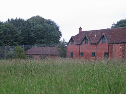
Buckholt, Hampshire
| Buckholt | |
| Hampshire | |
|---|---|
 Buckholt Farm | |
| Location | |
| Grid reference: | SU277321 |
| Location: | 51°5’17"N, 1°36’18"W |
| Data | |
| Population: | 17 (2011) |
| Post town: | Salisbury |
| Postcode: | SP5 |
| Local Government | |
| Council: | Test Valley |
| Parliamentary constituency: |
Romsey and Southampton North |
Buckholt is a hamlet in western Hampshire, close to the border with Wiltshire and about ten miles north of Romsey. Its stands on the line of the Roman road between Venta Belgarum (Winchester) and Sorviodnum (Old Sarum) and following that road into the village are two waymarked walking trails, the Clarendon Way and the Monarch's Way.
The 2001 census recorded a population of just 17.
Outside links
| ("Wikimedia Commons" has material about Buckholt, Hampshire) |
