Kelstedge
| Kelstedge | |
| Derbyshire | |
|---|---|
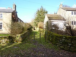
 A footpath in Kelstedge | |
| Location | |
| Grid reference: | SK339638 |
| Location: | 53°10’14"N, 1°29’39"W |
| Data | |
| Postcode: | S45 |
| Local Government | |
| Council: | North East Derbyshire |
Kelstedge is a hamlet in Derbyshire sitting just a mile north-west of Ashover, on the A632 Matlock to Chesterfield road, Kelstedge being about halfway between the two.
The village pub is The Kelstedge.
Outside links
| ("Wikimedia Commons" has material about Kelstedge) |
