Knocklyon
| Knocklyon Irish: Cnoc Lín | |
| County Dublin | |
|---|---|
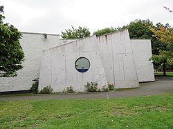
 Knocklyon parish church | |
| Location | |
| Grid reference: | O120274 |
| Location: | 53°17’8"N, 6°19’14"W |
| Data | |
| Local Government | |
| Council: | South Dublin |
| Dáil constituency: |
Dublin South-West |
Knocklyon is a developed suburban village in County Dublin, in the south of the county and within the conurbation which fills much of the county Unlike many Dublin suburbs, Knocklyon was not developed around a village; rather it largely comprises modern housing built between the village of Templeogue and Firhouse. A number of old cottages and farmhouses along the Knocklyon Road attest to the area's rural past.
Name
The area has been known historically[1] in 14th century scrolls as Cnoclín, literally 'flax mountain'. The Irish language name was lost though and roadsigns required to be bilingual were erected naming the village Cnoc Liamhna, meaning 'Lyon's hill'. The new Irish name, 'Cnoc Lín ('hill of flax') was adopted as a recommendation from a commissioned update on Irish placenames.[1]
Location
Knocklyon is located among the southwestern suburbs of Dublin city, in the foothills of the Dublin Mountains and south of the line of the River Dodder. It is bordered to the east and south by Rathfarnham, to the north by Templeogue, and to the west by Firhouse and Ballycullen.
The M50 motorway divides Knocklyon, with most of the suburb lying east of the motorway. Housing estates to the east include Idrone, Knocklyon Avenue, Beverly, Dargle Wood, Coolamber, Knockcullen, Lansdowne, Delaford, Knockaire, Orlagh, Scholarstown Park, Woodfield and Templeroan. To the west of the M50 are estates such as Castlefield, Glenlyon, Glenvara and Woodstown. The western and eastern portions of the suburb are linked by the Firhouse Road, by the flyover at Junction 12 of the M50 motorway, and by a footbridge close to where the Old Knocklyon Road formerly met Ballycullen Road.
About the village

Knocklyon Shopping Centre contains a supermarket and other retail outlets. There are also two shopping areas in the Orlagh and Woodstown estates. Both are anchored by a supermarket and have a number of fast food take-aways shops, as well as beauty salons and childcare centres. There are a number of pubs in the wider area, including Delany's and the Blue Haven.
Knocklyon has a number of open spaces within its residential estates and by the River Dodder, including the home ground and playing pitches for both a GAA club (Ballyboden St. Enda's GAA )and a soccer club, Knocklyon United F.C.
Churches
- Church of Ireland: (Church in Rathfarnham)[2]
- Roman Catholic: St Colmcille, which is run by the Carmelite Order
- Independent evangelical: The Knocklyon Church of Christ
Sport and leisure
- Gaelic Athletics: Ballyboden St Enda's GAA
- Football:Knocklyon United F.C.
- Athletics: Brothers Pearse A.C.
- Scouts
- South Dublin Model Railway Club[3]
A division of the St. John Ambulance provides first aid training in the community.
Outside links
| ("Wikimedia Commons" has material about Knocklyon) |