Gunby, Yorkshire
| Gunby | |
| Yorkshire East Riding | |
|---|---|
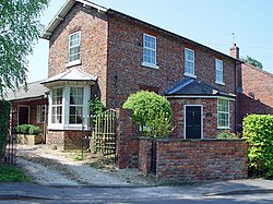
 A house on Breighton Road, Gunby | |
| Location | |
| Grid reference: | SE710353 |
| Location: | 53°48’35"N, -0°55’21"W |
| Data | |
| Postcode: | YO8 |
| Local Government | |
Gunby is a tiny hamlet in the East Riding of Yorkshire, sitting on the east bank of the River Derwent just south of Bubwith.
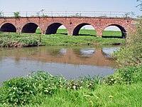
A railway line used to pass arrow-straight through the landscape here just north of Gunby, and its brick-built viaduct over the Derwent and the floodplan is still intact.

| ("Wikimedia Commons" has material about Gunby, Yorkshire) |
