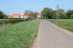
Manthorpe, Bourne
| Manthorpe | |
| Lincolnshire | |
|---|---|
 Manthorpe | |
| Location | |
| Grid reference: | TF070160 |
| Location: | 52°43’52"N, 0°24’54"W |
| Data | |
| Post town: | Bourne |
| Postcode: | NG31 |
| Local Government | |
| Council: | South Kesteven |
| Parliamentary constituency: |
Sleaford and North Hykeham |
Manthorpe is a small village in Kesteven, the south-western part of Lincolnshire. It is just half a mile east of the A6121 road, three miles south-west of Bourne and six miles north-east of Stamford.
At the western side of the village runs the East Glen River.
At Bowthorpe Park Farm stands the Bowthorpe Oak, which has the largest girth of any tree in the United Kingdom; a circumference of forty feet.
Outside links
| ("Wikimedia Commons" has material about Manthorpe, Bourne) |
