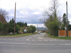
Frankley
| Frankley | |
| Worcestershire | |
|---|---|

| |
| Location | |
| Grid reference: | SO995785 |
| Location: | 52°25’20"N, 2°-0’45"W |
| Data | |
| Population: | 122 (2001[1]) |
| Post town: | Birmingham |
| Postcode: | B32, B45 |
| Dialling code: | 0121 |
| Local Government | |
| Council: | Bromsgrove |
| Parliamentary constituency: |
Bromsgrove |
Frankley is a village and parish in the Halfshire hundred of Worcestershire, on the border with Birmingham. The modern Frankley estate is part of the New Frankley civil parish in Birmingham, and has been part of the city since 1995.[2] The rural civil parish has a population of 122.[1]
History
Frankley is listed within the hundred of Cane in Worcestershire in the 1086 Domesday Survey.[3] In the mid-12th century Cane was combined with other Domesday hundreds to form the hundred of Halfshire.
St Leonards Church
The 15th-century[4] church building lies to the north of the village.[5] The building is constructed from sandstone in a red and grey colour, until 1965 the tower contained two bells.[5] A new church hall was constructed in 2005.[6]
Frankley services
The village gives its name to Frankley services, a motorway service area on the M5 motorway to the north-west of the village. The services opened with the motorway in 1966.[7]
References
- ↑ 1.0 1.1 Census 2001
- ↑ http://www.newfrankleyinbirminghamparishcouncil.gov.uk/profile.asp
- ↑ Open Domesday Online: Frankley. Accessed November 2018.
- ↑ http://www.british-history.ac.uk/report.aspx?compid=43096#s3
- ↑ 5.0 5.1 http://www.british-history.ac.uk/report.aspx?compid=43096
- ↑ New Church Hall for St Leonards Church, Frankley, Worcestershire
- ↑ "Archived copy". Archived from the original on 2009-04-02. https://web.archive.org/web/20090402030150/http://www.msatrivia.co.uk/chron.htm. Retrieved 2009-02-17.
Outside links
| ("Wikimedia Commons" has material about Frankley) |
- Frankley in the Domesday Book

This Worcestershire article is a stub: help to improve Wikishire by building it up.
