North Killingholme
| North Killingholme | |
| Lincolnshire | |
|---|---|
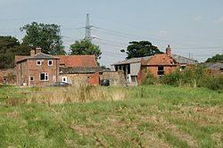 Manor Farm, North Killingholme | |
| Location | |
| Grid reference: | TA178145 |
| Location: | 53°38’25"N, 0°16’30"W |
| Data | |
| Population: | 224 (2001) |
| Post town: | Immingham |
| Postcode: | DN40 |
| Dialling code: | 01469 |
| Local Government | |
| Council: | North Lincolnshire |
| Parliamentary constituency: |
Cleethorpes |
North Killingholme is a small village in the Lindsey part of Lincolnshire. It has a population of just 224 (as in 2001) but is close to and serves its part in the industry of the area. Along with its larger neighbour South Killingholme, it makes up the area of Killingholme.
The village is between Grimsby and Scunthorpe, slightly closer to the former. Next to the village is the hamlet of Garden Village.
The village
The parish church is St Denys.
The village has a small village hall, but there is no public house, the nearest is the Cross Keys at South Killingholme, and there is The Ashbourne hotel and restaurant.
In March 2007, it was announced that flood defences in the area will be improved by the Environment Agency.[1]
Industry
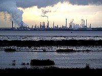
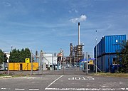
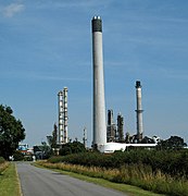
Lying next to the ConocoPhillips-owned Humber Refinery and Total's Lindsey Oil Refinery, the residential village is subjected to heavy traffic passing through its single main road at the times of work shifts commencing and ending. ConocoPhillips and Total have attempted to combat this by erecting signs and circulating newsletter notices to its workforce.
The village was brought to national and even international attention in the first half of 2009 when a series of strikes at the Lindsey Oil Refinery broke out over the use of foreign labour.[2]
North Killingholme Industrial Estate is situated at Lancaster Approach. Among the units is a large storage warehouse.
The village's closeness to the Humber estuary means that the area is an important shipping location featuring Humber Sea Terminals Ltd.
In June 2008, Spanish insulation firm Ursa announced plans to build a £66 million base close to the village which would create up to 130 new jobs. The plant will reportedly produce around 90,000 tonnes of glass wool each year. Ursa said it was attracted to the area because of its transport links.[3]
On 27 June 2010 a fire broke out at the site. One 24-year-old man died. The other three people who were caught in the blow are being kept in hospital for burns.
Parish church
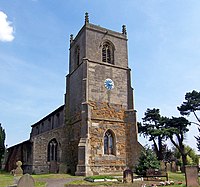
The church of St Denys dates at the earliest to the Norman period, with a 12th-century priest's door, as well as the arch at the base of the tower. The chancel is 13th-century, and the nave 14–15th century, with a clerestory added in the 16–17th century. The church was built mainly of limestone and ironstone, with brick, chalk, flint and rubble work, and some ashlar dressing. The church was restored in the 1700s, 1847, 1868, 1889, 1910 and 1926 including a new chancel arch, and brick buttresses. The font is 14th-century.[4][5][6]
The church is a Grade I listed building.[7]
The present vicarage to the church dates to the mid-1800s and is a Grade II listed building.[8]
History
Evidence of prehistoric settlement in the Killingholme area includes Neolithic stone axes found close to the village in the late 1890s.[9] Part of an Iron Age or Roman period stone quern has been found in land between North and South Killingholme.[10]
About half a mile north of the village is the medieval moated site known as North Garth, with an inner bailey 40 yards by 20 yards, and moats six yards wide and three to five feet deep. To the south are further enclosures, also ditched or moated to a depth of three feet.[11][12][note 1]
The site of the deserted medieval village of Holtham (TA14771675) may lie approximately halfway between North and South Killingholme.[13]
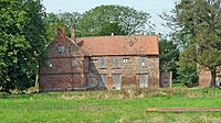
A second moated site is found around Manor Farm, consisting of two areas. The larger, 260 yards by 200 yards, has a moat of around 30 feet 6 feet wide by deep, still water-filled in parts; a smaller moated area of 55 yards square is located in the north-west corner of the first with its northern and western moats formed by the outer moat.[14] A red brick and pantile farmhouse (former manor house, where the Booth family had their seat until the 18th century[15]) within the site dates to the 1500s (east wing), with a west wing added in the 17th century. The older wing is thought to be the remains of a larger manor house. {{#invoke:Footnotes | harvard_citation }} states the old house was thought to date to the reign of King Henry VII, though current thought places what remains of it in the reign of Elizabeth I.[16][17][4] To the east a stables/granary dates to the mid 1700s.[18]
Both North and South Killingholme were enclosed in 1779 when the Booth family were lords of the manor.[19][20] In 1821 the parish of North Killingholme, including the hamlet of South Killingholme, had a population of 438.[21] By 1872 the parish contained 770 persons of which 196 were in North Killingholme.[22] In this period (1880s) the parish was almost entirely agricultural, excluding a small brick and tile works near North Killingholme Haven; almost all of the agricultural land was regular enclosed fields; there were two small woods, Burkinshaw's Covert and Chase Hill Wood, north-east of the village.[23] Excluding the developments on the Humber Bank at the Haven the general situation in the parish remained unchanged to the Second World War, with only minor growth of the village – a subsidiary development of a few houses to the south-west of the village centre, named Garden Village.[24]
At North Killingholme Haven clay extraction for cement manufacture took place from 1909 to 1913. Additionally a pier for fuelling Royal Navy ships was constructed c. 1912;[25] and a seaplane base opened nearby in 1914 and closed 1919.[26]
As part of the development of the Immingham Dock, a branch line, the Humber Commercial Railway (operational 1901), was constructed from a junction near Ulceby railway station running northeast through the parish towards the new dock.[27][28]
An airfield was established south-west of the village during the Second World War as RAF North Killingholme, and used extensively by heavy bomber squadrons. Much of the airfield was built during the Second World War including the three concrete runways, and hangars, storehouses and offices.[29][30] Additionally two heavy anti-aircraft batteries were sited in the parish during the Second World War.[31][32]
In the post Second World War period much of the land near the Humber north-west of Grimsby was developed for heavy or large scale industrial use. (see Industry of the South Humber Bank.) The "Lindsey Oil Refinery" was developed by Total Oil and Fina north-east of the village of North Killingholme from 1968.[33] The village was relatively unchanged by these developments, though the number of dwellings had roughly doubled by the beginning of the 1970s, mainly scattered detached and semi-detached houses.[24]
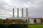
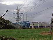
In 1960 the Central Electricity Generating Board acquired a 360-acre site near Killingholme, and in 1972 obtained consent for a 4 GW oil fired power station, some enabling construction work was begun, but the project was abandoned after the 1973 oil crisis. In 1985 the Killingholme site was listed as a possible NIREX disposal site for low level nuclear waste, causing substantial opposition both locally and from the council. In 1986 the Board listed Killingholme as a potential site for a coal fired power station.[34] In 1992 Powergen constructed a 900 MW combined cycle gas fired powerstation north of the Lindsey Oil Refinery,[35] known as Killingholme B power station. In 1993 National Power selected the proposed oil powerstation site for a CCGT power station, the approximate 650 MW Killingholme A power station.[36]
From the 1990s onwards a Roll-on/Roll-off ferry terminal, was constructed at the haven: the first two berths opened 2000; a second pair c. 2004; and a third pair after 2006.[25] (see Humber Sea Terminal.)
By the 21st century housing development at village had completed infilling at the satellite Garden village, and created two continuous rows of houses near east of the traditional centre along St Crispin's Close and Church Lane, approximately 10 structures per side on each road, mostly semi-detached houses or higher status.[37]
History
North Killingholme was formerly the home of No. 550 Squadron RAF - a mixture of British, Canadian, New Zealander and Australian personnel - which flew Lancaster bombers from the RAF North Killingholme airbase from early 1944 to October 1945.[38] RAF 550 Squadron is credited with opening the D-day attack on 5 June 1944.[39] The airfield remains to this day, although it is in much disrepair.
Manor Farm House is an L-shaped brick house dating to the early to mid-16th century, with additions from the 18th century.[40] It is built within a partially moated site, some of which is still visible to the north of the house. It was likely reduced to a farmhouse in 1700. The two ranges, one 16th century in origin and the other likely to be from around 1700 when extensive remodelling took place,are now in a poor state of decay. However, the house has been made watertight and filled with supportive scaffolding, because it is a grade II* listed building. English Heritage are currently carrying out a feasibility study on the property.
The village was a railway station on the New Holland and Immingham Dock branch of the Great Central Railway.[41]
See also
Outside links
| ("Wikimedia Commons" has material about North Killingholme) |
References
- ↑ BBC News Online - Defence fear for flood-risk homes
- ↑ Stop stealing our jobs: Thousands of oil workers across Britain walk out in row over influx of foreign labour - Daily Mail Online
- ↑ Company announces £66m jobs boost - BBC News Online
- ↑ 4.0 4.1 Pevsner, Harris & Antrim 2002, p. 583.
- ↑ Cite error: Invalid
<ref>tag; no text was provided for refs namedstd - ↑ Cite error: Invalid
<ref>tag; no text was provided for refs namedstd2 - ↑ National Heritage List 1103701: Church of St Denys (Grade I listing)
- ↑ National Heritage List 1214966: The Old Vicarage (Grade II listing)
- ↑ Cite error: Invalid
<ref>tag; no text was provided for refs namedsa - ↑ Cite error: Invalid
<ref>tag; no text was provided for refs namedrq - ↑ Cite error: Invalid
<ref>tag; no text was provided for refs namedng - ↑ Cite error: Invalid
<ref>tag; no text was provided for refs namedng2 - ↑ Cite error: Invalid
<ref>tag; no text was provided for refs namedholtham - ↑ Cite error: Invalid
<ref>tag; no text was provided for refs namedmfms - ↑ @www.ota.ox.ac.uk
- ↑ Cite error: Invalid
<ref>tag; no text was provided for refs namedmf - ↑ Cite error: Invalid
<ref>tag; no text was provided for refs namedmf2 - ↑ Cite error: Invalid
<ref>tag; no text was provided for refs namedmfb - ↑ Kain, Roger J.P.; Chapman, John; Oliver, Richard R. (2004). The Enclosure Maps of England and Wales 1595–1918. Cambridge University Press. ISBN 052182771X.
- ↑ Russell, Eleanor; Russell, Rex Charles (1982). Landscape changes in South Humberside: the enclosures of thirty-seven parishes. Humberside Leisure Services. pp. 107-.
- ↑ Allen 1834, p. 231.
- ↑ White, William (1872). History, Gazetteer and Directory of Lincolnshire, and the City and Diocese of Lincoln (3rd ed.). p. 542. https://books.google.co.uk/books?id=VplQAAAAYAAJ.
- ↑ Ordnance Survey. 1:2500 1887
- ↑ 24.0 24.1 Ordnance Survey. 1:2500 1887, 1908, 1932, 1966–70, 1970–1, 1972
- ↑ 25.0 25.1 See North Killingholme Haven
- ↑ Philpott, Ian (2013). The Birth of the Royal Air Force. p. 265. ISBN 9781781593332.
- ↑ Dow 1965, pp. 233–236.
- ↑ Ordnance Survey 1:2500 1907–8, 1932
- ↑ Cite error: Invalid
<ref>tag; no text was provided for refs namedrafk - ↑ Cite error: Invalid
<ref>tag; no text was provided for refs namedrafkb - ↑ Cite error: Invalid
<ref>tag; no text was provided for refs namedaa1 - ↑ Cite error: Invalid
<ref>tag; no text was provided for refs namedaa2 - ↑ Lewis & Jones 1970, pp. 190–191.
- ↑ Symes 1987, pp. 44–46.
- ↑ Midttun, A., ed (1997). European Electricity Systems in Transition. Table III.4, p.66.
- ↑ "GT13E gas turbines to power Killingholme A GTCC plant". Modern Power Systems. 1 January 1993. http://business.highbeam.com/4364/article-1G1-13538798/gt13e-gas-turbines-power-killingholme-gtcc-plant. Retrieved 9 August 2015.
- ↑ Cite error: Invalid
<ref>tag; no text was provided for refs namedosm - ↑ Australian Daily Telegraph - Flying flag of Anzac pride
- ↑ No. 550 Squadron - RAF History at mod.uk
- ↑ Royal Commission on the historical monuments of England, Historic Buildings Report: Manor Farm House, North Killingholme. Lincs (Sept 1996). National Monuments Centre, Kemble Drive, Swindon SN2 2GZ.
- ↑ Killingholme - GENUKI
Cite error: <ref> tags exist for a group named "note", but no corresponding <references group="note"/> tag was found
