Langton Long Blandford
| Langton Long Blandford | |
| Dorset | |
|---|---|
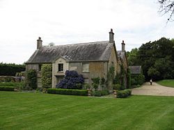
 The Old Rectory | |
| Location | |
| Grid reference: | ST897059 |
| Location: | 50°51’10"N, 2°8’45"W |
| Data | |
| Post town: | Blandford Forum |
| Postcode: | DT11 |
| Local Government | |
| Council: | Dorset |
| Parliamentary constituency: |
North Dorset |
Langton Long Blandford is a small village in Dorset. It is sited by the River Stour, about three-quarters of a mile south-east of Blandford Forum.
In 2013 the estimated population of the parish was 120.[1]
Forming the south-eastern line of the parish boundary is an old track linking prehistoric Buzbury Rings, on nearby Keyneston Hill, to a ford over the river.[2]
St Leonards farmhouse used to house a leper hospital.[2]
The parish church was rebuilt in 1862.[2]
References
- ↑ "Parish Population Data". Dorset County Council. 20 January 2015. https://www.dorsetforyou.com/344882. Retrieved 20 January 2015.
- ↑ 2.0 2.1 2.2 North Dorset District Council (c. 1983). North Dorset Official District Guide. Home Publishing Co. Ltd. p. 37.