Great Ganilly
| Great Ganilly | |
 Great Ganilly | |
|---|---|
| Location | |
| Grid reference: | SV947145 |
| Area: | 34 acres |
| Data | |
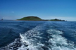
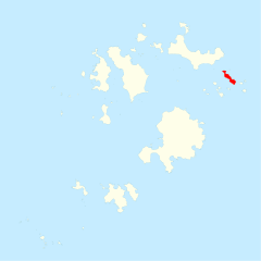
Great Ganilly is one of the Eastern Isles of the Isles of Scilly, Cornwall.
Great Ganilly has a total area of 34 acres and its highest point reaches 112 feet above sea level, in the middle of the island. There are two known Cairns near the summit.
The name comes from the Cornish Guen Hily, meaning "the saltwater downs".
References
- Weatherhill, Craig: Cornish Placenames and Language. (Sigma Press 1995, 1998, 2000) ISBN 1-85058-462-1
| Isles of Scilly |
|---|
|
St Mary's •
St Agnes •
Tresco •
Bryher •
St Martin's •
Gugh
|
