Gloucestershire Way

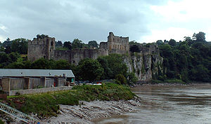
The Gloucestershire Way is a long-distance footpath of 100 miles, in Gloucestershire. It runs from Chepstow Castle in Monmouthshire and then across the Wye at Tutshill borrowing the route of the Offa's Dyke Path, and then crosses the width of the county to Stow on the Wold before looping back to Tewkesbury.
The route was devised by Gerry and Kate Stewart, of the Ramblers Association and Tewkesbury Walking Club. The route uses existing rights of way.
The route
The Gloucestershire Way runs through all the distinct parts of Gloucestershire; the Forest of Dean, the Vale of Gloucester and the Cotswolds.
The starting point is in Chepstow, but it at once crosses the River Wye into Gloucestershire at Tutshill (51°38’53"N, 2°39’58"W). The Way then heads east, crossing the River Severn at Gloucester, then continuing eastwards into the Cotswolds to the hills’ renowned market town, Stow on the Wold. The route then winds back throught the Wolds north-westward to finish at Tewkesbury (51°59’46"N, 2°8’13"W).
Am additional day's walk can link the route to the south end of the Worcestershire Way at Great Malvern.
The published stages are:
| Chepstow to Parkend | 13.5 miles |
| Parkend to May Hill | 14 miles |
| May Hill to Gloucester | 13 miles |
| Gloucester to Crickley | 12 miles |
| :Crickley to Salperton | 12 miles |
| Salperton to Stow-on-the-Wold | 11 miles |
| Stow to Winchcombe | 13 miles |
| Winchcombe to Tewkesbury | 11.5 miles |
| (Worcestershire Way Link | 12 miles) |
Outside links
- The Gloucestershire Way at the Long Distance Walkers Association
- Walking Pages on the Glos Way
- Countryside Matters on the Glos Way with basic map
References
- Stewart, G. (1996) The Gloucestershire Way; published by Countryside Matters ISBN 0-9527870-0-8