Green Tye
| Green Tye | |
| Hertfordshire | |
|---|---|
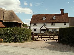
 Grudd's Farmhouse, Green Tye | |
| Location | |
| Grid reference: | TL446185 |
| Location: | 51°50’48"N, -0°5’53"E |
| Data | |
| Postcode: | SG10 |
| Local Government | |
| Council: | East Hertfordshire |
Green Tye is a hamlet in the east of Hertfordshire, east of Much Hadham and west of Bishop's Stortford. The name 'Tye' refers to an area of outlying roadside common land or green, alternatively a settlement surrounding common land or green.
The Hertfordshire Way long-distance walking route touches Green Tye on its winding route hereabouts.
See also
- Matching Tye, Essex
Outside links
| ("Wikimedia Commons" has material about Green Tye) |
