Template:FP-Clocaenog Forest
From Wikishire
Revision as of 20:44, 26 February 2018 by RB (talk | contribs) (Created page with "{{#switch:{{{1}}} |pic=Clocaenog lane - geograph.org.uk - 176040.jpg |cap=Lane in the Clocaenog Forest, Denbighshire |text=The '''Clocaenog Forest''' is in Denbighshire, o...")
(diff) ← Older revision | Latest revision (diff) | Newer revision → (diff)
Jump to navigation Jump to search
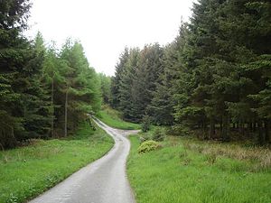
Lane in the Clocaenog Forest, Denbighshire

Clocaenog Forest

The Clocaenog Forest is in Denbighshire, on the Denbigh Moors. It takes its name from the village of Clocaenog, near Ruthin.

The forest is forty square miles in extent, mostly coniferous softwoods under the control of the Forestry Commission. It was planted in 1905 on what was mostly moorland and many hill farms in a highland region, mostly above 1,150 feet. (Read more)