Slievenanee
| Slievenanee | |||
| County Antrim | |||
|---|---|---|---|
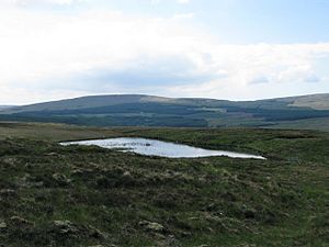
 Slievenanee behind Loughnacarry | |||
| Range: | Antrim Hills | ||
| Summit: | 1,781 feet D167213 55°1’32"N, 6°10’33"W | ||
Slievenanee is a mountain in the Antrim Hills of County Antrim, reaching 1,781 feet. It is to the west of the head of Glenariff and to the north of Cargan which is at the head of the glen of the Clogh River.
Though a tall hill itself, it is exceeded by the mountain it adjoins to the north-east: Trostan, the Highest point in County Antrim at 1,804 feet. To the west is the more modest Skerry Hill (1539 feet).
The name of the mountain is from the Gaelic language; Sliabh na Nia [Buile Shuibhne*], which would mean "Mountain of the warriors".