Potter Fell
| Potter Fell | |||
| Westmorland | |||
|---|---|---|---|
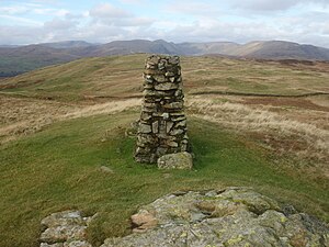
 The summit cairn of Brunt Knott | |||
| Range: | Lake District Outlying Fells | ||
| Summit: | 1,401 feet NY484006 54°23’54"N, 2°47’46"W | ||
Potter Fell is a fell near the villages of Burneside and Staveley, Westmorland. Its summit is known as Brunt Knott, which stands at 1,401 feet.
A number of tarns lie on the flank of the fell, including Gurnal Dubs Tarn and Potter Tarn.[1]
Potter Fell has four major summits, two of which, Brunt Knott and Ulgraves, are mentioned in Alfred Wainwright's The Outlying Fells of Lakeland.[2]
Summits

Potter Fell is made up of four separate peaks, two of which are unnamed.
- The first unnamed summit (1,296 feet) is reached directly by way of the ascent from Bowston near Burneside.[3]
- Brunt Knoll (1,401 feet), the true summit, stands further north from the first unnamed summit. It is marked by a stone triangulation station at its highest point.[4]
Between these first two summits is a small pool of water with a wall running through it, which Wainwright named 'wall through a pool'[4]
- A second unnamed summit east of the first two stands at 1,280 feet.[3]
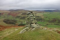
- Ulgraves (1,089 feet) is further east.[5] Like Brunt Knott, the highest point is marked by a trig point. The summit of Ulgraves looks over the Longsleddale valley.[6]
Wainwright's clockwise route starts on the road between Bowston and Staveley and passes the four summits, two named and two nameless, as described above.[2]
Tarns

There are a number of tarns on Potter Fell, of which Gurnal Dubs and Potter Tarn are the most significant.
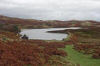
Potter Tarn is located at the bottom of the ascent to the unnamed summit (1,296 feet).[3] The tarn supplies water to Croppers Paper Mill in Burneside and its flow is moderated by a concrete dam. The present water level is around half of its 1990 level, when the dam was lowered. The outflow from Potter Tarn issues into Ghyll Pool before the stream descends towards the paper mill.[7]
Gurnal Dubs is a popular place for recreational fishing and the licences are managed by the Kent Angling Association.[8] It is located to the west of Ulgraves and south of the unnamed summit of 1,296 feet.[3] The tarn is home to a boathouse that was renovated in 1985.[7]
See also
References
- ↑ Geograph profile, retrieved 30 September 2008
- ↑ 2.0 2.1 Wainwright, Alfred: The Outlying Fells of Lakeland (1974)
- ↑ 3.0 3.1 3.2 3.3 Lakeland Fells – Potter Fell
- ↑ 4.0 4.1 Stridingedge.net – The Outlying Fells of Lakeland A-Z
- ↑ The Lakeland Fells – Ulgraves
- ↑ Wainwright Wanderings – Walk 113
- ↑ 7.0 7.1 Nutall, J. (1995), The Tarns of Lakeland – Vol II: East, p. 149
- ↑ Lakeland Fishing – Gurnal Dubs, retrieved 30 September 2008