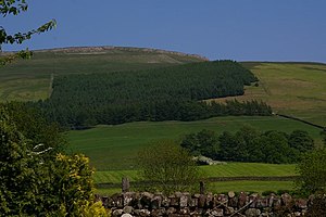
Melmerby Fell
| Melmerby Fell | |||
| Cumberland | |||
|---|---|---|---|
 Melmerby Fell from Melmerby | |||
| Range: | Pennines | ||
| Summit: | 2,326 feet NY652380 54°44’10"N, 2°32’29"W | ||
Melmerby Fell is a hill of 2,326 feet at the western edge of the Pennines, and the east of Cumberland. It stands to the north-west of Cross Fell and its scarp slope faces the village of Melmerby, two miles to the west.
A Roman road]], the Maiden Way, passes over the fell just below its summit, on its way north to the Hartside Pass and on to South Tynedale. The head of the Hartside Pass is to the north, below a subsidiary top of Melmerby Fell known as Fiend's Fell (2,080 feet).