Foxfield
| Foxfield | |
| Lancashire | |
|---|---|
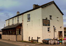
 The Prince of Wales public house, Foxfield | |
| Location | |
| Grid reference: | SD208854 |
| Location: | 54°15’29"N, 3°12’54"W |
| Data | |
| Post town: | Broughton-in-Furness |
| Postcode: | LA20 |
| Dialling code: | 01229 |
| Local Government | |
| Council: | Westmorland & Furness |
| Parliamentary constituency: |
Barrow and Furness |
Foxfield is a village on the west coast of the Furness peninsula of Lancashire. It lies on the Duddon Estuary, which separates Lancashire from Cumberland, just outside the Lake District National Park. Foxfield is around ten miles to the north-east of Barrow-in-Furness and one mile out of Broughton-in-Furness.[1] It is part of the parish of Broughton West.
Foxfield is best known for the Prince of Wales Pub, which has its own micro-brewery.[2] The town also contains Foxfield railway station on the coastal line from Carnforth to Carlisle, where a branch line to Broughton and Coniston used to commence.[3]
References
| ("Wikimedia Commons" has material about Foxfield) |
- ↑ "CUMBRIAN COAST LINE | Barrow-in-Furness to Carlisle Railway Line - Foxfield". http://www.cumbriancoastline.co.uk/?Places_To_Visit:Foxfield. Retrieved 2015-04-23.
- ↑ "Prince of Wales Hotel". http://www.princeofwalesfoxfield.co.uk/. Retrieved 2015-04-23.
- ↑ "The Furness Railway Company". Archived from the original on 2007-07-15. https://web.archive.org/web/20070715153252/http://www.furnessrailwaytrust.org.uk/frco.htm. Retrieved 2015-04-23.

This Lancashire article is a stub: help to improve Wikishire by building it up.
