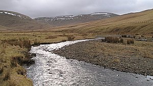
Fruid Water

The Fruid Water is a river in Peeblesshire, much changed from it once natural form as much of its course has been dammed to oblivion.
The river rises in a number of burns running of the northern slopes of Hart Fell, on the boundary of Peeblesshire with Dumfriesshire, from which it follows a course northwards, though the fell country, without a village by its banks nor barely a house. It is a tributary of the Tweed, which it meets a mile upstream of Tweedsmuir.
The river's valley now forms the Fruid Reservoir, by the building of a dam a mile and a half above its meeting with the Tweed, below which the waters are released to flow down towards the main river.
The river basin covers nine square miles.[1]
References
- Location map: 55°28’53"N, 3°26’53"W
- ↑ Hydrology - Section 2: The catchments of the Tweed and the Eye - The Tweed Foundation