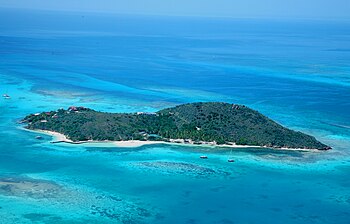
North Sound of Virgin Gorda


The North Sound of Virgin Gorda is the broad, island-flecked water lying to the north of Virgin Gorda, one of the main islands of the British Virgin Islands.
The North Sound is a distinctive, shallow, sheltered water hemmed with a ring of islands and banks, bounded on the south and east by the shores of Virgin Gorda itself, reaching out a long eastward finger, on the north by reefs and banks reaching out westwards around a series of smaller islands as far as Mosquito Island in the west.
By extension also, the islands of the Sound can be deemed to include Necker Island to the north, which is separated from the rest by the Virgin Sound, the deeper water channel being just 500 yards or so broad.
The reefs and islands enclose some 3,000 acres of sheltered waters, which makes the North Sound one of the world’s top anchorages.
These waters are popular with boaters and its shores bristle with marinas and jetties. At the eastern end of the sound is the islands’ premier anchorage at John O' Point, with a shoreline a mile long. Here is the Bitter End Yacht Club named as this may have been the last place at which Sir Francis Drake and Sir John Hawkins trod what became British soil, at their fleet rendezvous in 1595 before the expedition to San Juan de Puerto Rico.
The islands in the sound are the northernmost of the territory until Anegada away to the north. The main islands of the sound are:
Outside links
- North Sound of Virgin Gorda – BVI Tourism
- Map of the North Sound – Bareboats BVI