Turkey Brook


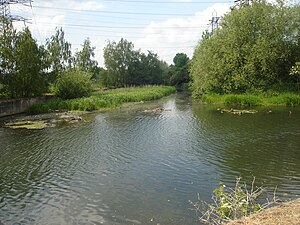
The Turkey Brook rises near the Fir and Pond Woods Local Nature Reserve near Potters Bar, Middlesex and makes its way to join the River Lea at Enfield Lock.
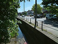
The brook eastward from Potters Bar and is joined by other streams including Cuffley Brook, Cattlegate Brook and the Small River Lea. Along its course it flows through Cuffley, Crews Hill Golf Club and Clay Hill, and forms a pretty ornament to Whitewebbs Park, going on to Forty Hill and Albany Park before fallin into the River Lee Navigation below Enfield Lock.
Name of the Brook
The brook named from the street which is recorded as Tokestreete 1441, Tuckhey strete 1610, Tuckey street 1615, Turkey street 1805, probably 'street of houses (i.e. hamlet) associated with a family called Toke(y).
The modern form of the name Turkey, not in use before the 19th century, is no doubt due to folk etymology.[1]
Fish
The brook is mostly shallow, fast flowing and clean and can support wildlife. Coarse fish including dace use the brook to spawn.
References
- ↑ Mills A. D. Oxford Dictionary of London Place Names (2001) p231 ISBN 0198609574 Retrieved 25 October 2008