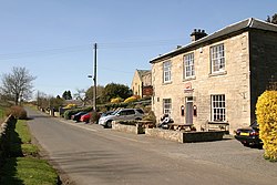
Middleton, Northumberland
| Middleton | |
| Northumberland | |
|---|---|
 The Ox Inn, Middleton | |
| Location | |
| Grid reference: | NU085365 |
| Location: | 55°37’19"N, 1°52’1"W |
| Data | |
| Population: | 115 (2011) |
| Post town: | Belford |
| Postcode: | NE70 |
| Local Government | |
| Council: | Northumberland |
| Parliamentary constituency: |
Berwick-upon-Tweed |
Middleton is a village in Northumberland, on the North Sea coast, south of Holy Island. Its wider parish contains the villages of Middleton itself, along with Ross, Detchant and Elwick; all are shrunken mediæval villages.
At the 2011 census there were recorded just 115 inhabitants of the parish.
Both the A1 London to Edinburgh road and East Coast Main Line pass through the parish.
About the village
The Devil's Causeway passes the village of Middleton just over a mile to the east. The causeway is a Roman road which starts at Port Gate on Hadrian's Wall, north of Corbridge, and extends fifty-five miles northwards across Northumberland to the mouth of the River Tweed at Berwick-upon-Tweed.
Outside links
| ("Wikimedia Commons" has material about Middleton, Northumberland) |
