Kirkheaton, Northumberland
For the village in Yorkshire see Kirkheaton
| Kirkheaton | |
| Northumberland | |
|---|---|
 Kirkheaton | |
| Location | |
| Grid reference: | NZ015775 |
| Location: | 55°5’31"N, 1°58’41"W |
| Data | |
| Post town: | Newcastle Upon Tyne |
| Postcode: | NE19 |
| Dialling code: | 01830 |
| Local Government | |
| Council: | Northumberland |
| Parliamentary constituency: |
Hexham |
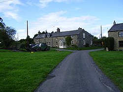
Kirkheaton is a village in Northumberland. The village lies about ten miles north-east of Hexham and about five miles west of Belsay.
Sights of the village

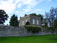
Kirkheaton has a Pele tower.
The Devil's Causeway passes the village just over a mile to the east. The causeway is a Roman road which starts at Port Gate on Hadrian's Wall, north of Corbridge, and extends 55 miles northwards across Northumberland to the mouth of the River Tweed at Berwick-upon-Tweed.
Parish church
The church is dedicated to St Bartholomew.[1] The chapel was rebuilt in 1775, at the expense of Mrs. H. D. Windsor, at that time lady of the manor.[2]
Outside links
| ("Wikimedia Commons" has material about Kirkheaton, Northumberland) |
References
- ↑ Purves, Geoffrey (2006). Churches of Newcastle and Northumberland. Stroud, Gloucestershire, England: Tempus Publishing Limited. pp. 163. ISBN 0 7524 4071 3. http://www.tempus-publishing.com.
- ↑ Information on Kirkheaton, Northumberland from GENUKI
