Wadhurst
| Wadhurst | |
| Sussex | |
|---|---|
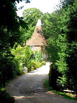
 Oast House at Yeomans, Wadhurst | |
| Location | |
| Grid reference: | TQ640318 |
| Location: | 51°3’36"N, -0°20’24"E |
| Data | |
| Population: | 4,818 (2007 est.) |
| Post town: | Wadhurst |
| Postcode: | TN5 |
| Dialling code: | 01892 |
| Local Government | |
| Council: | Wealden |
| Parliamentary constituency: |
Wealden |
| Website: | Wadhurst Parish Council |
Wadhurst is a small market town in Sussex. The civil parish of Wadhurst also includes the hamlets of Cousley Wood and Tidebrook.
Wadhurst is a small market town, and has kept a very good range of shops considering its size. It has a traditional butcher, baker, ironmonger, hairdresser, bank, post office, gift shop, several pubs and much more. Such a wide range of small traders and services is almost unique in the villages in the locality. The population of the ward was 5,075 at the 2001.[1]
Location

Wadhurst is beside the Kent-Sussex border seven miles east of Crowborough and about seven miles south of Tunbridge Wells. Other nearby villages include Ticehurst, Burwash, Mayfield and Heathfield, all in Sussex, and Lamberhurst, Hawkhurst and Cranbrook in Kent.
Physically, Wadhurst lies on a high ridge of the Weald - a range of wooded hills running across Sussex and Kent between the North Downs and the South Downs. The reservoir of Bewl Water is nearby. The River Bewl, which is a sub-tributary of the River Medway, and the Limden rise within the civil parish of Wadhurst.
History
The name Wadhurst is Anglo-Saxon and may come from the name Wada, or waða ("hunter") or any number of possibilities form the Old English language. There is an Anglo-Saxon manor known as Bivelham which lay between the parishes of Wadhurst and Mayfield.
Although Wadhurst was almost certainly in existence at the time of the Great Survey in 1086, it is not listed in the resultant Domesday Book. It seems though to have been part of the Archbishop of Canterbury's land and was therefore not mentioned. The earliest record relating to the area is a reference in the Cartulary of Battle Abbey to "Snape in the parish of Wadhurst"
Henry III granted Wadhurst its charter in 1253, allowing Wadhurst to hold a market every Saturday and a fair on 29 June, the feast of St Peter and St Paul.
In the 16th, 17th and 18th centuries Wadhurst, as did many towns and villages in the Weald, had a thriving iron industry. Two of the large Georgian buildings in the High Street, Hill House and The Old Vicarage, were both ironmasters' houses, along with a number of other large houses on the outskirts of Wadhurst. In the parish church there are several iron ledger-stone memorials of ironmasters, which are unique to this area.
The Victorian era saw the town expand towards the new railway station, about a mile and a half north of the town. The station is on the line from London (Charing Cross) to Hastings via Tunbridge Wells, and was opened in 1851 by the South Eastern Railway. The resulting expansion brought the hamlets of Sparrow's Green, Turners Green and Best Beech Hill into the town.
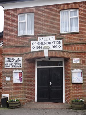
During World War I, Wadhurst lost 149 men, out of a total village population of 3,500. The worst losses were during the Battle of Aubers Ridge, when 25 men from Wadhurst were killed in one day: nearly 80% of the men from Wadhurst who went into No Man's Land that day.[2]
On 20 January 1958 a Royal Air Force Gloster Meteor night fighter WS661, on a training flight from RAF North Luffenham, crashed into the High Street. A number of shops and buildings were destroyed or damaged. The accident killed both of the Meteor crew and two people on the ground.
Churches
The parish church is St Peter and St Paul; parts of the church date from the 12th century.[3]
Churches include:
- Church of England:
- St Peter and St Paul
- Methodist: Wadhurst Methodist Church, founded in 1874.
- Roman Catholic
The three churches participate in Churches Together, along with St John the Baptist in Tidebrook, and St Peter in Stonegate.[4]
Buildings and people

The Church of St. Peter and St Paul dominates the centre of the town. Wadhurst's heritage as a centre of the iron industry is shown by the many iron gravestones in the church. There are two early Georgian houses on the High Street, the Old Vicarage and Hill House. On the outskirts is the 19th century Wadhurst Castle.
The rest of the town is in a variety of vernacular styles, from the 15th century onwards; and little in the centre of the town is very modern apart from a range of shops which replaced the Queens Head Hotel, demolished in a jet crash in the 1950s.
There are two early 19th century former Strict Baptist chapels of similar design in the hamlets of Pell Green (Rehoboth Chapel) and Shover's Green (the Shover's Green Baptist Chapel).[5] Both are listed at Grade II.[6][7]
Sport
- Football: Wadhurst United FC, based at the Recreation Ground on South View Road
Outside links
| ("Wikimedia Commons" has material about Wadhurst) |
References
- ↑ "National Statistics - Neighbourhood statistics by ward". http://neighbourhood.statistics.gov.uk/dissemination/areasubject.do.
- ↑ Kelly, Jon (11 November 2011). "Thankful villages: The places where everyone came back from the wars". BBC News. http://www.bbc.co.uk/news/magazine-15671943. Retrieved 11 November 2011.
- ↑ The church building, St Peters and St Pauls church website
- ↑ Churches Together in Wadhurst, wadhurst.info
- ↑ Stell, Christopher (2002). Nonconformist Chapels and Meeting-houses in Eastern England. Swindon: English Heritage. p. 352. ISBN 1-873592-50-7.
- ↑ Images of England — details from listed building database (296835) Detailed Record: Baptist Chapel, Wadhurst
- ↑ Images of England — details from listed building database (296813) Rehoboth Chapel, Pell's Green
- Savidge, Alan and Oliver Mason. (1988): Wadhurst: Town of the High Weald.] Gillingham: Meresborough. 10-ISBN 0-948193-35-2; 13-ISBN 978-0-948-19335-4; OCLC 20798945
