Pwll
| Pwll | |
| Carmarthenshire | |
|---|---|
 Pwll, Carmarthenshire | |
| Location | |
| Grid reference: | SN473010 |
| Location: | 51°41’15"N, 4°12’33"W |
| Data | |
| Postcode: | SA15 |
| Dialling code: | 01554 |
| Local Government | |
| Council: | Carmarthenshire |
| Parliamentary constituency: |
Llanelli |
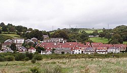
Pwll is a small coastal village in Carmarthenshire, sitting between Llanelli and Burry Port. The village is concentrated along the north of the A484. The land rises away from the coast providing a view of the Gower Peninsula.
The village has a local shop, post office, a few pubs and a primary school. There is a King George V Playing Field, which hosts the village's football and cricket teams.