Little Trees Hill
| Little Trees Hill | |||
| Cambridgeshire | |||
|---|---|---|---|
 Little Trees Hill | |||
| Range: | Gog Magog Hills | ||
| Summit: | 243 feet TL488529 52°9’16"N, -0°10’25"E | ||
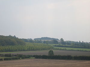
Little Trees Hill is the highest point of the Gog Magog Downs, a ridge of low chalk hills extending for several miles to the southeast of Cambridge in Cambridgeshire; it climbs to 243 feet; high by Cambridgeshire standards.
Access
The summit is reachable by a public footpath, from the Magog Down car park on Haverhill Road, Stapleford to the top. The highest inches are behind a fence in a wood, but most visitors will be content to survey the view from the seats by the fence.
The panorama westward is stunning; looking northwest there is no higher ground for 50 miles until the Lincolnshire Wolds (though the view doers not extend that far). The city of Cambridge is laid out before you, with Addenbrooke's Hospital large close by and the colleges a distance beyond. The Madingley Hills can be seen over the other side of the Cam valley and Castle Hill in Cambridge is prominent. To the southwest, Rowley's Hill and the obelisk on St Margaret's Mount can be seen through binoculars.
A pleasant circular walk can be made by following the path northeast towards the A1307 for a quarter of a mile, then taking the footpath back to the car park. The hill is popular with dog walkers.
The other summit in the range is Wandlebury Hill about 550 yards to the northeast. The two are connected by a low ridge.
Outside links
| ("Wikimedia Commons" has material about Hills of Cambridgeshire) |
