Manger Beg
| Manger Beg TOWNLAND | |
| Fermanagh | |
|---|---|
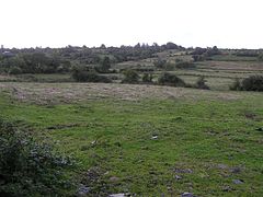
 Running down to the Bradoge in Manger Beg | |
| Location | |
| Location: | 54°27’57"N, 8°9’38"W |
| Grid reference: | G87445732 |
| Data | |
Manger Beg is a townland in Fermanagh, containing no village but farms. It is the westernmost townland of the county and its western corner, bounded on two sides by the Republic of Ireland (County Donegal and County Leitrim) is the westernmost point in the inhabited lands of the United Kingdom; only the deserted rocks of St Kilda and Rockall lie further west.
The county (and the kingdom) comes to an end on the Bradoge River, which runs through the townland, eventually forming its southern boundary, to the westernmost point by Bradoge Bridge (a hamlet just across the border).