Streap
| Streap | |||
| Argyllshire, Inverness-shire | |||
|---|---|---|---|
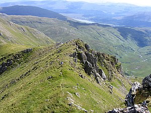
 The east ridge from the summit of Streap | |||
| Range: | Morar | ||
| Summit: | 2,982 feet NM94668637 56°55’23"N, 5°22’32"W | ||
Streap is a mountain in Morar, standing on the northernmost boundary of Argyllshire with Inverness-shire. Reaching 2,982 feet, it narrowly fails to qualify as a Munro, but is listed as a 'Corbett'.
A subsidiary top, Streap Comhlaidh at 2,946 feet, stands half a mile to the southeast at NM952860, also marking the county boundary.
Streap and Streap Comhlaidh are on a long ridge that separates Glen Finnan, in Inverness-shire, from Gleann Dubh Lighe in Aryll (about 3 miles northeast of the town of Glenfinnan).