Pass of Drumochter


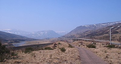
The Pass of Drumochter (Gaelic: Bealach Druim Uachdair) is the main mountain pass between the northern and southern central Highlands, running from Pitlochry and up Glen Garry in Perthshire to the upper Spey in Inverness-shire.
The A9 road runs through the pass, as does the Highland Main Line, the railway between Inverness and the cities of the Lowlands. The Sustrans National Cycle Route 7 between Glasgow and Inverness also makes its way through the pass.
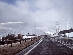
The top of the Pass of Drumochter is the highest point on the A9, at 1,508 feet on the county border, between A' Mharconaich and A' Bhuidheanach), and in wintertime this stretch of the pass can be subject to severe weather conditions. There are routine winter patrols from November to March, and the road is occasionally closed with snow gates near Dalwhinnie and Dalnacardoch.
The summit of the railway line is 1,480 feet, making it the highest in the United Kingdom.
The route through the pass has been used since prehistory. It is used by the RAF as a main route for low level flying and Tornados and other fast jets may often be seen here.

The pass was formed by glacial action during successive Ice Ages. From this place the River Garry flows to the south through Perthshire, and the River Truim to the north.
It is isolated, and the nearest settlement of any size is the small village of Dalwhinnie, some 7 miles to the north.
References
| ("Wikimedia Commons" has material about Pass of Drumochter) |
Coordinates: 56°51′35″N 4°14′55″W / 56.85964°N 4.24856°W
