Meesden
| Meesden | |
| Hertfordshire | |
|---|---|

| |
| Location | |
| Grid reference: | TL429316 |
| Location: | 51°57’54"N, -0°4’45"E |
| Data | |
| Postcode: | SG9 |
| Local Government | |
| Council: | East Hertfordshire |
Meesden is a hamlet in Hertfordshire, in the hilly parts in the very northeast of the county, close to the border with Essex. Brent Pelham (with which it shares a civil parish) is a mile to the south. Anstey lies along the lane to the west.
North across the county border (marked here by the upper streams of the River Stort) is Langley, which is close to Essex's highest point.
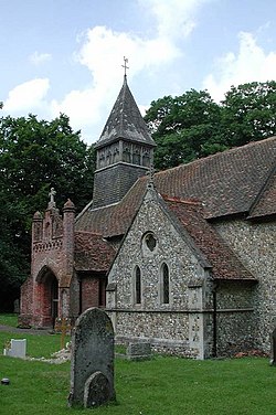
The parish church is St Mary's.[1]
Outside links
- http://www.hertfordshire-genealogy.co.uk/data/places/places-m/meesden.htm
- Listed buildings in Meesden
- http://www.visionofbritain.org.uk/place/place_page.jsp?p_id=5345
- Genuki
References
- ↑ Church of St Mary, Meesden – British Listed Buildings