Osmotherley, Lancashire
| Osmotherley | |
| Lancashire | |
|---|---|
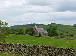
 St John's Church, Osmotherley | |
| Location | |
| Grid reference: | SD268815 |
| Location: | 54°13’27"N, 3°7’24"W |
| Data | |
| Local Government | |
Osmotherley is a parish in Lancashire North of the Sands without any village as such but with a scattering on moorland hamlets, extending north from Ulverston.
The parish church is St John the Evangelist's Church (SD27908215), which stands alone by the lane running south-west from Broughton Beck, beside one of the farms of the parish. It is the only listed building in the parish (grade II).[1] It was built by Austin and Paley in the late 1800s as a daughter church to St Mary in Ulverston.
The Cumbria Way long distance walking route, which links the three shires of the Lake District, runs through the parish and past the church.
Outside links
| ("Wikimedia Commons" has material about Osmotherley, Lancashire) |
- Parish Council of Egton-with-Newland, Mansriggs and Osmotherley
- Osmotherley through time - Vision of Britain
- Information on Osmotherley, Lancashire from GENUKI

References
- ↑ National Heritage List 1086796: Church of St John Evangelist
