Salenside
| Salenside | |
| Roxburghshire | |
|---|---|
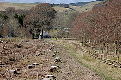
 The Border Abbeys Way approaching Salenside | |
| Location | |
| Grid reference: | NT465209 |
| Location: | 55°28’44"N, 2°50’53"W |
| Data | |
| Post town: | Selkirk |
| Postcode: | TD7 |
| Local Government | |
| Council: | Scottish Borders |
Salenside is a village off the A7, on the Ale Water, near Ashkirk, in Roxburghshire. There was a Salenside Tower house, but nothing remains of it. Salenside Farm and Salenside Cottage exist.
Records show that Salenside Tower, a fortified tower, stood here. While nothing of this tower is known to be left, it is possible nevertheless that Salenside cottage, on a knoll south of Salenside farm, is actually the converted base of the tower.<red>Salenside Tower: RCAHMS</ref>
Other places nearby include Appletreehall, Essenside, Hawick, Lilliesleaf, Philiphaugh, and Woll.
Outside links
References
- Morris and Morris, R and F (1982) 'Scottish healing wells: healing, holy, wishing and fairy wells of the mainland of Scotland, Sandy, page 175, held at RCAHMS G.2.4.MOR