Pooley Bridge
| Pooley Bridge | |
| Westmorland | |
|---|---|
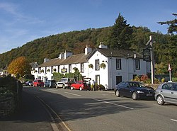
 The Sun Inn, Pooley Bridge | |
| Location | |
| Grid reference: | NY471244 |
| Location: | 54°36’43"N, 2°49’14"W |
| Data | |
| Post town: | Penrith |
| Postcode: | CA10 |
| Dialling code: | 017684 |
| Local Government | |
| Parliamentary constituency: |
Penrith and the Border |
Pooley Bridge is a village in northern Westmorland close to the border with Cumberland. It takes its name from the bridge over the River Eamont at the northern end of Ullswater which here forms the county boundary. There is a pier from which ferries (known as the Ullswater 'Steamers') provide connections to Glenridding and Howtown. Pooley Bridge was formerly known as Pooley or Pool How meaning the hill by the pool or stream. The name Pool How was derived from the Old English word pollr plus the Old Norse haugr meaning hill or mound.[1][2]
Pooley is mostly situated in the civil parish of Barton, of which it is the main settlement. The few houses on the northern or Cumberland side of the bridge are in Dacre parish.[3] The village is popular with tourists, especially during the summer, and has several hotels, guest houses and camping sites.
References
Outside links
| ("Wikimedia Commons" has material about Bridge Pooley Bridge) |
- Large Sunny Images of Pooley Bridge
- Pictures of Pooley Bridge
- The Horse and Farrier, 18th Century Inn, Near Pooley Bridge
- Lakeland Walks
- Lake District Walks
- Pooley Bridge from another angle
- Lake District Walks - Pooley Bridge

This Westmorland article is a stub: help to improve Wikishire by building it up.
